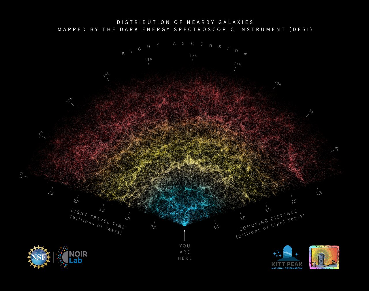
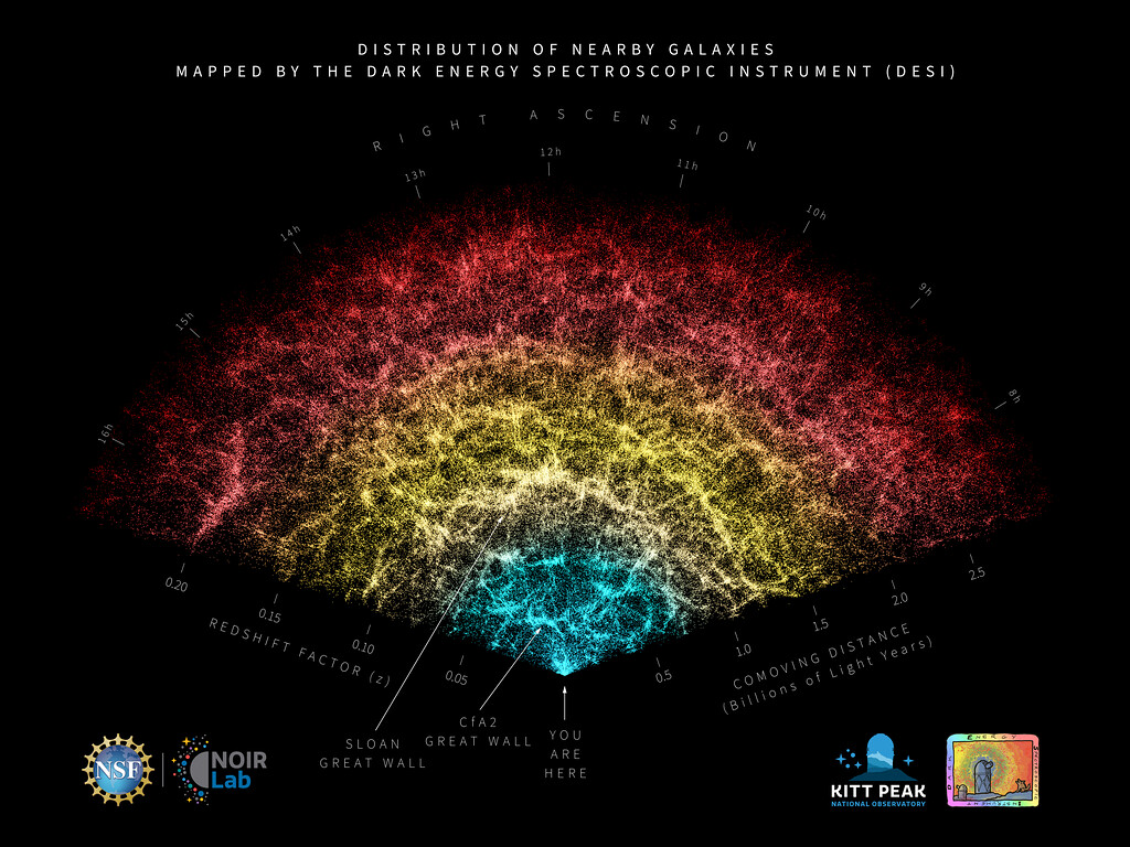
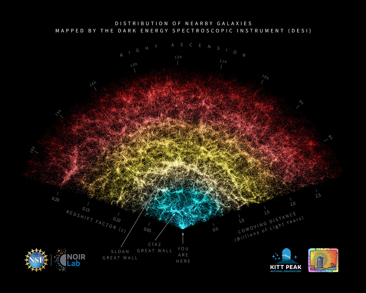
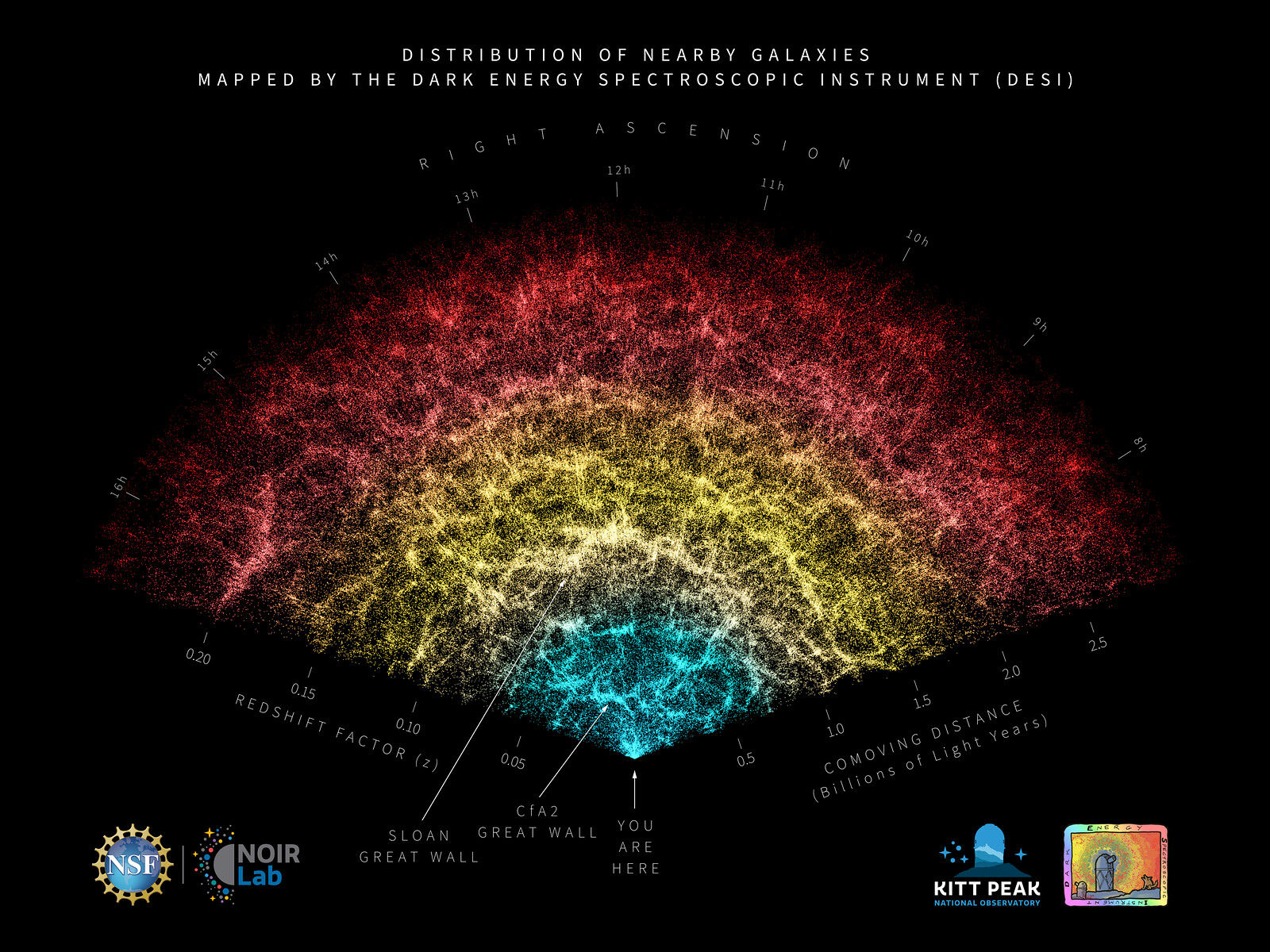
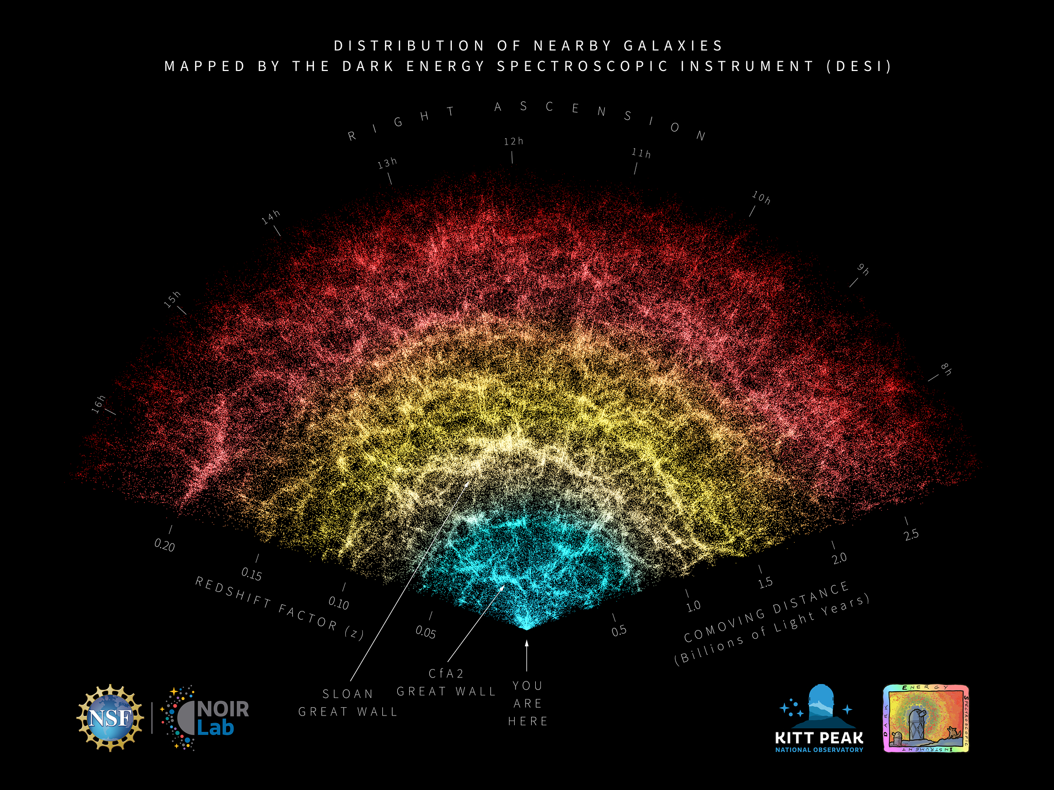
DESI Year-One Data Slice (annotated)
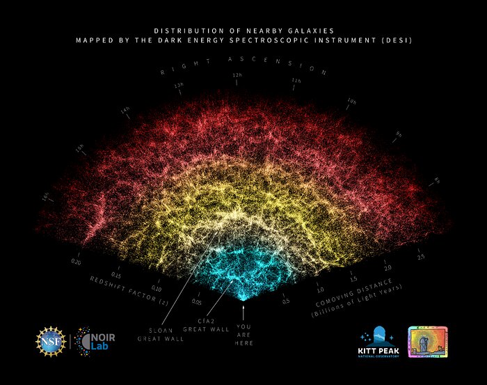
A slice of the 3D map of galaxies collected in the first year of the Dark Energy Spectroscopic Instrument (DESI) Survey with annotations identifying key features in the map. Earth is at the tip, with the furthest galaxies plotted at distances of 11 billion light-years. Each point represents one galaxy. This version of the DESI map includes 600,000 galaxies — less than 0.1% of the survey's full volume.
Credit:DESI Collaboration/NOIRLab/NSF/AURA/R. Proctor
About the Image
| Id: | noirlab2408c |
| Type: | Artwork |
| Release date: | April 4, 2024, 8 a.m. |
| Related releases: | noirlab2408 |
| Size: | 20000 x 15807 px |
About the Object
| Category: | Illustrations |